Search results for :
GIS / Remote Sensing
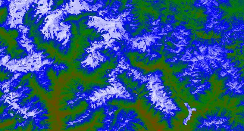
Normalized Difference Snow Index (NDSI)
Published on May 17, 2020
NDSI is a measure of the relative magnitude of the reflectance difference between visible (green) and shortwave infrared (SWIR).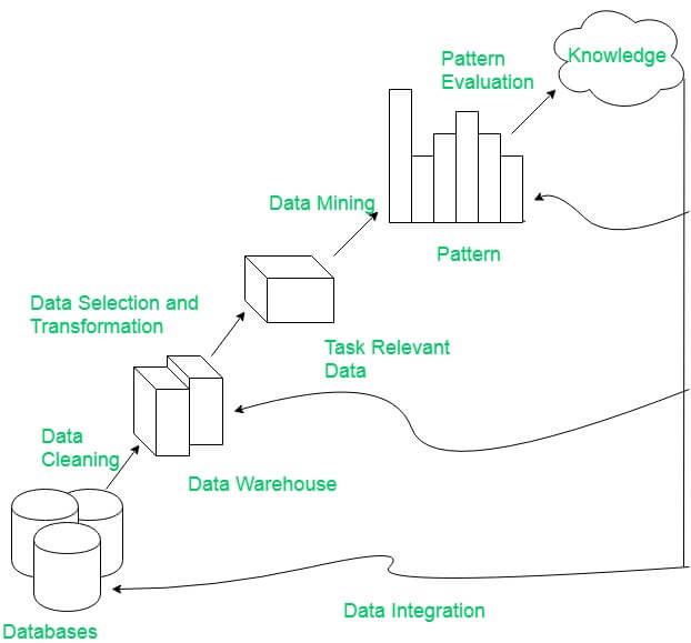
Integrate Google Earth Engine(GEE), Pandas framework and Matplotlip - Spatial Data Mining
Published on Apr 04, 2020
Discovery Pattern in Spatial data, extract potentially useful information from data stored in images and visualize the result in dynamic charts.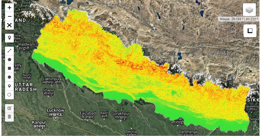
Generate Slope Elevation data from SRTM - Python API
Published on Apr 11, 2020
Digital elevation data is an international research effort that obtained digital elevation models on a near-global scale. This SRTM V3 product (SRTM Plus) is provided by NASA JPL at a resolution of 1 arc-second (approximately 30m).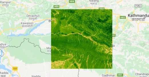
Calculate NDVI and export
Published on May 19, 2020
Normalized Difference Vegetation Index (NDVI) quantifies vegetation by measuring the difference between near-infrared (which vegetation strongly reflects) and red light (which vegetation absorbs).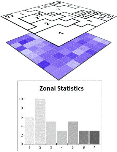
Calculate Zonal Statistics and export as CSV
Published on Jul 10, 2020
Get statistics in each zone of the image or image collection in google earth engine and export the data in CSV. Statistics are simple tools that help us for a better understanding of our images. Spatial statistics is one of the most rapidly growing areas of statistics.
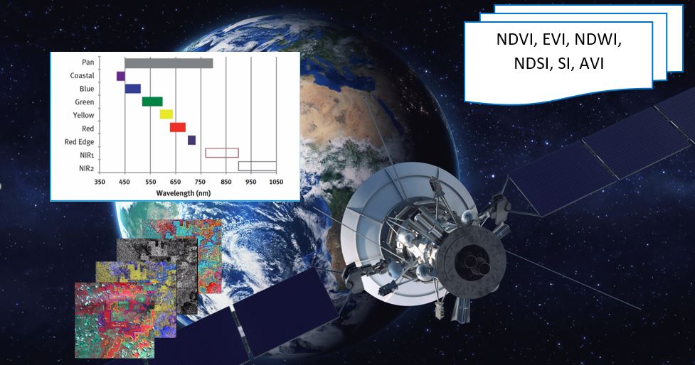
All you need to know about NDVI
Published on May 07, 2020
The Normalized Difference Vegetation Index is a simple indicator of photosynthetically active biomass or, in layman’s terms, a calculation of vegetation health.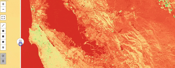
All you need to know about EVI
Published on May 11, 2020
EVI is similar to Normalized Difference Vegetation Index (NDVI) and can be used to quantify vegetation greenness. However, EVI corrects for some atmospheric conditions and canopy background noise and is more sensitive in areas with dense vegetation.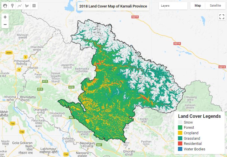
Land Cover Mapping - Part 1
Published on May 31, 2020
The surface of the Earth is continuously changing at many levels; local, regional, national, and global scales. Changes in land use and land cover are pervasive, rapid, and can have significant impacts on people, the economy, and the environment.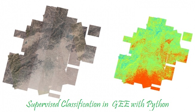
Supervised Classification in GEE
Published on May 10, 2020
Supervised classification is the technique most often used for the quantitative analysis of remote sensing image data.
Land Cover Mapping - Part 2
Published on May 31, 2020
The surface of the Earth is continuously changing at many levels; local, regional, national, and global scales. Changes in land use and land cover are pervasive, rapid, and can have significant impacts on people, the economy, and the environment.
Google earth engine with python
Published on May 07, 2020
In addition to the web-based IDE Google Earth Engine also provides a Python API that can be used on your local machine.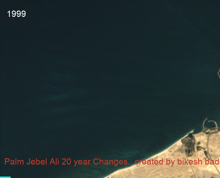
20 year Time-series change of Mega projects
Published on Jun 09, 2020
20 year Time series analysis of megaproject using Landsat satellite.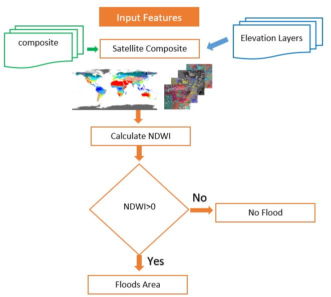
All you need to know about NDWI: Normalized Difference Water Index
Published on May 12, 2020
The Normalized Difference Water Index (NDWI) is remote sensing derived index estimating the leaf water content at the canopy level.NDVI time series with Google Earth Engine
Published on Sep 19, 2020
Time series animations of Earth observation imagery are captivating and engaging. In this tutorial, you'll learn how to generate an animated GIF.