Search results for :
Google Earth Engine
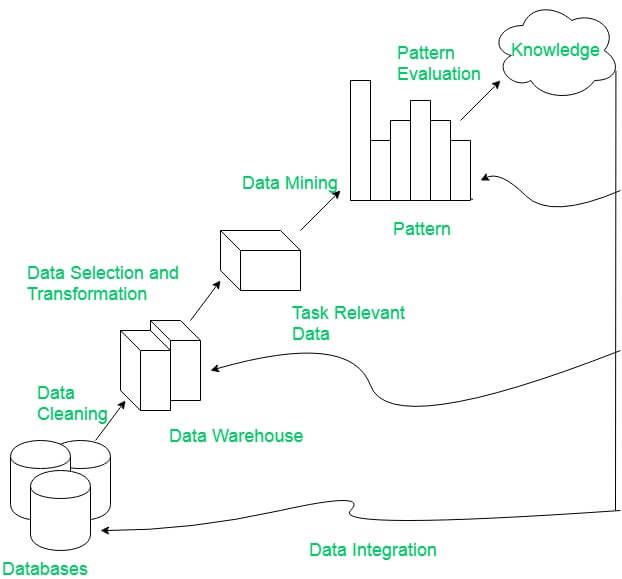
Integrate Google Earth Engine(GEE), Pandas framework and Matplotlip - Spatial Data Mining
Published on Apr 04, 2020
Discovery Pattern in Spatial data, extract potentially useful information from data stored in images and visualize the result in dynamic charts.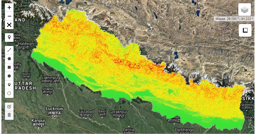
Generate Slope Elevation data from SRTM - Python API
Published on Apr 11, 2020
Digital elevation data is an international research effort that obtained digital elevation models on a near-global scale. This SRTM V3 product (SRTM Plus) is provided by NASA JPL at a resolution of 1 arc-second (approximately 30m).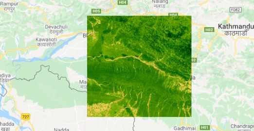
Calculate NDVI and export
Published on May 19, 2020
Normalized Difference Vegetation Index (NDVI) quantifies vegetation by measuring the difference between near-infrared (which vegetation strongly reflects) and red light (which vegetation absorbs).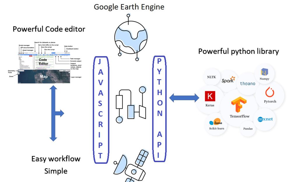
Google earth engine Detail comparison between Python and JavaScript
Published on Apr 13, 2020
Both the Python and JavaScript APIs access the same server-side functionality, but it is different in the syntax and the way we digest.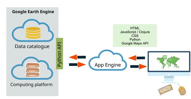
Introduction to the Google Earth Engine Python API
Published on Apr 13, 2020
This tutorial will go over how to set up the API on your local machine as well as some basic Python scripts utilizing the Google Earth Engine Python API
Google Earth Engine as WMS Layer - Using Python API
Published on Apr 02, 2020
The Python API provides a programmatic and flexible interface to Earth Engine for automating batch processing tasks, and leveraging the power of the command line.
Geo-pandas data frame to GEE feature collection using Python
Published on Apr 27, 2020
The simplest way to convert shapefile, CSV it into ee.FeatureCollection is to infuse the Geopandas data frame with GEE python API.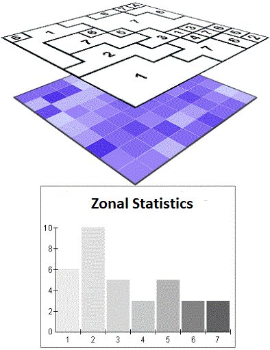
Calculate Zonal Statistics and export as CSV
Published on Jul 10, 2020
Get statistics in each zone of the image or image collection in google earth engine and export the data in CSV. Statistics are simple tools that help us for a better understanding of our images. Spatial statistics is one of the most rapidly growing areas of statistics.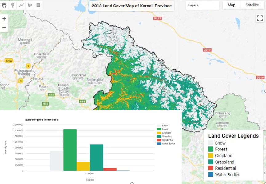
Land Cover Mapping - Part 4 (Analyze Statistics)
Published on Jun 08, 2020
Statistics are simple tools that helps us for a better understanding of our images. Spatial statistics is one of the most rapidly growing areas of statistics.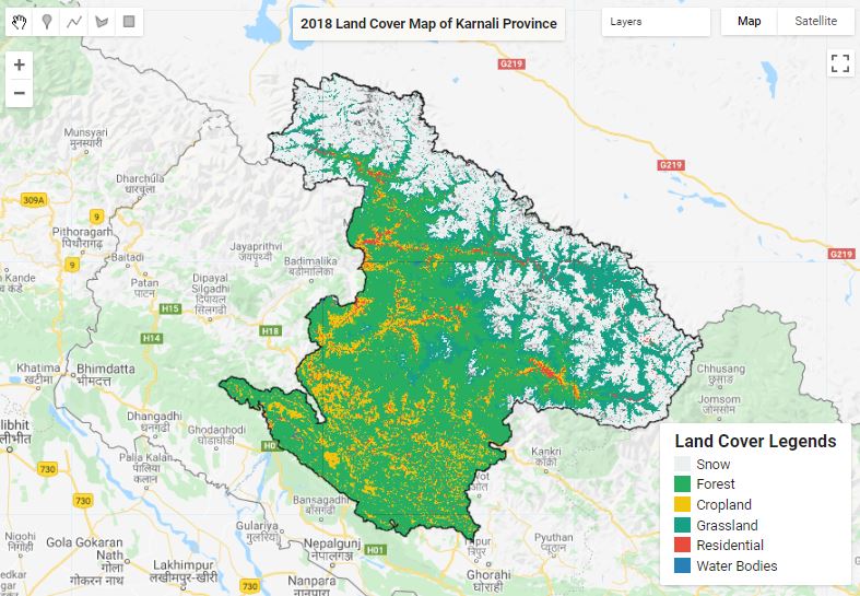
Land Cover Mapping - Part 1
Published on May 31, 2020
The surface of the Earth is continuously changing at many levels; local, regional, national, and global scales. Changes in land use and land cover are pervasive, rapid, and can have significant impacts on people, the economy, and the environment.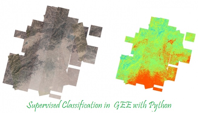
Supervised Classification in GEE
Published on May 10, 2020
Supervised classification is the technique most often used for the quantitative analysis of remote sensing image data.
Land Cover Mapping - Part 2
Published on May 31, 2020
The surface of the Earth is continuously changing at many levels; local, regional, national, and global scales. Changes in land use and land cover are pervasive, rapid, and can have significant impacts on people, the economy, and the environment.
Google earth engine with python
Published on May 07, 2020
In addition to the web-based IDE Google Earth Engine also provides a Python API that can be used on your local machine.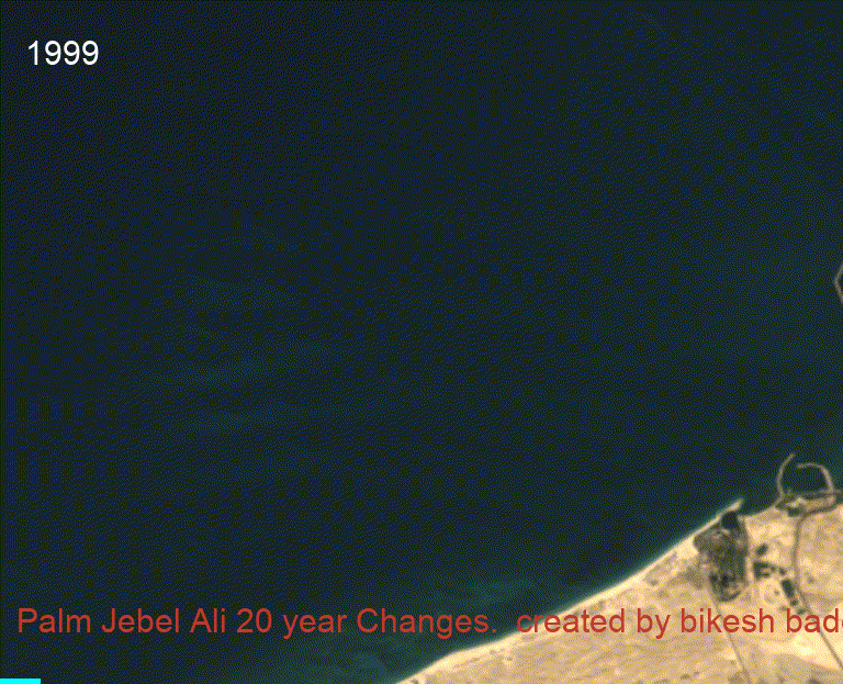
20 year Time-series change of Mega projects
Published on Jun 09, 2020
20 year Time series analysis of megaproject using Landsat satellite.