SATELLITE IMAGERY - Link to asses free satellite imagery
Published on Apr 08, 2020 | Bikesh | 3482 Views
Satellite images give a good representation of what is happening at every point in the world, especially over oceans where large gaps in data occur. Data can only be taken at certain points around the world, though, without this data, forecasting would be just as difficult as not having satellites. It is essential to have both. Having the two together gives a much better understanding as to how the atmosphere is behaving and greatly improves forecasting accuracy.
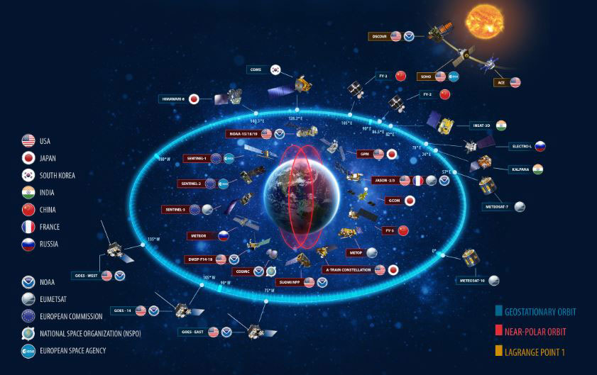
There are two types of satellites that orbit the Earth, polar and geostationary. Geostationary Operational Environmental Satellites (GOES) remain above a fixed location on the Earth's surface, approximately 22,500 km above the equator. Because the satellites rotate with the Earth, they always view the same portion of the globe. The polar-orbiting satellites, in contrast, orbit at much lower elevations (800-900 km). Their path is 2,400 km wide centered at the orbit path. The polar satellites observe a new path on each orbit. Polar satellites are not as useful to operational meteorologists because they do not continuously view the same area. Geostationary satellites allow meteorologists to view the weather as it develops since they view the same area continuously.
FREE SATELLITE IMAGERY SOURCES
1. USGS EARTH EXPLORER
EarthExplorer is an undisputed leader among free satellite imagery sources in terms of data variety but not the most user-friendly service, especially to a non-expert. It may take a while to familiarize yourself with all the buttons, menu options, and datasets available. So be prepared that your first search for satellite images can be quite time-consuming. EarthExplorer.
2. LANDVIEWER
LandViewer is the best satellite imagery source for GIS beginners and experts from other industries (agriculture, forestry, construction) who don’t use special GIS software and are looking for free updated satellite imagery with fast and accurate analytics included. LandViewer
3. COPERNICUS OPEN ACCESS HUB
Copernicus Open Access Hub can be recommended as a source of all the Sentinels’ free satellite imagery. However, if you’re after data from Sentinel-1 or 2, consider trying out other data sources offering the same images with slightly better user experience. Copernicus Open Access Hub
4. SENTINEL HUB
EO Browser is an easy-to-master web service with a decent selection of free medium-resolution satellite imagery. One of its advantages is the ability to analyze and visualize image data. Sentinel Playground is more of a for-fun service for exploring and sharing fragments of the satellite imagery mosaic of the world. EO Browser
5. NASA EARTHDATA SEARCH
Earthdata Search is truly an ocean of NASA’s Earth observation data, which a researcher or a scientist can dive into. It’s not the best free satellite imagery source for amateurs, who may start from more user-friendly services and probably come back to it later for filling the data gaps. Earthdata Search
6. REMOTE PIXEL
Remote Pixel is a very simple and fast satellite imagery service providing search across a limited list of datasets along with visualization tools. However, it may be not the best place for downloading data. Remote Pixel
7. INPE IMAGE CATALOG
INPE Image Catalog is recommended for users whose main interest lies in South and Central America or Africa. Unfortunately, this service doesn’t provide free global satellite images but, overall, is a good user-friendly option for quick search and download of images that can be later analyzed using another software. INPE Image Catalog

